
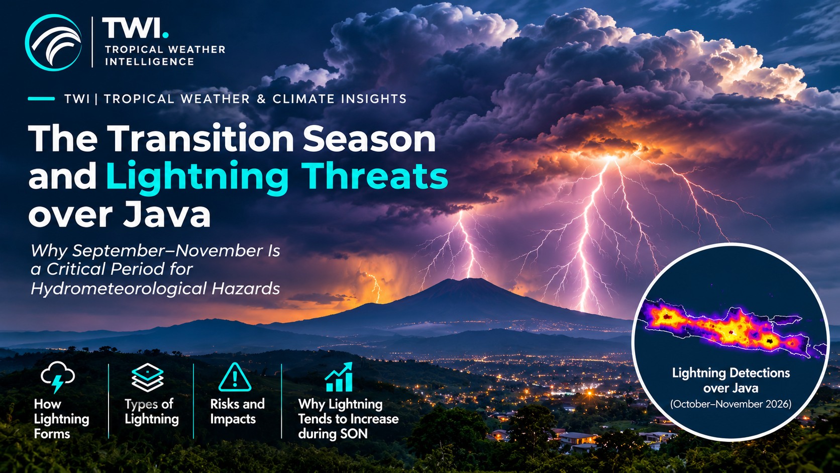
Why the September–November transition matters
Across Java, September–November (SON) often spans a changing seasonal circulation rather than a single, uniform onset of the rainy season. Daytime heating, changing low-level winds, growing moisture availability in some districts, and local terrain effects can converge to support deep afternoon or evening convection. The timing differs between northern coastal plains, central highlands and southern districts—and from one year to another.
This transition can be especially important for public safety because thunderstorms may develop rapidly near densely populated settlements, roads, schools, agriculture and outdoor work sites. A seasonal transition is a context for heightened awareness, however, not a guarantee that lightning frequency rises in every part of Java each September, October or November.
What is lightning?
Lightning is an atmospheric electrical discharge, generally associated with convective clouds—especially Cumulonimbus (Cb). It may occur within a cloud, between clouds, from a cloud into surrounding air, or between a cloud and the ground.
Within a growing thunderstorm, strong upward air currents carry moisture and hydrometeors toward colder levels. Collisions between graupel, ice crystals and supercooled liquid water contribute to charge separation. The resulting electric field can become strong enough to initiate a discharge. This is a coupled dynamical and microphysical process: moisture alone, or hot surface temperatures alone, do not generate lightning.
Four useful categories of lightning
Intracloud (IC) lightning occurs within a cloud and often dominates the flash count of active storms. Cloud-to-cloud (CC) lightning connects charge regions in different clouds. Cloud-to-air (CA) discharges extend outward into the surrounding air without reaching the surface. Cloud-to-ground (CG) lightning connects cloud and surface and represents a particularly direct danger to people, power networks and exposed infrastructure.
These categories describe discharge geometry rather than separate storm types. Even if rainfall has not begun at a location, a thunderstorm several kilometres away may already pose a lightning hazard; a flash can reach outside the main rain area.
Why convective activity can intensify during SON
Three environmental ingredients deserve attention: sufficient moisture, atmospheric instability and a lifting mechanism. Surface solar heating can create buoyant updrafts; sea-breeze boundaries, valley winds, convergence zones and terrain-driven circulations may focus ascent. As clouds deepen through the freezing level, ice-phase microphysics favours electrification.
In some situations, changes in vertical wind shear and storm organization allow convective cells to persist or regenerate. Thunderstorms can then produce not only lightning but also short-duration intense rainfall and strong downdraft-driven winds. The actual hazard depends on storm structure and local exposure, not merely the calendar month.
From lightning to wider hydrometeorological hazards
The same mature convective cloud may bring frequent lightning, heavy rain and locally damaging gusts. Prolonged or repeatedly developing cells can contribute to urban flooding and, on vulnerable slopes, landslide conditions. Strong downdrafts can spread near the surface as gust fronts or downbursts; localized rotation may occur in certain storm environments, but not every destructive wind is a tornado.
For communities, the practical consequence is to track short-term weather changes as carefully as seasonal outlooks. Darkening towers of cloud, sudden wind shifts, nearby thunder and rapidly intensifying rainfall warrant action, especially for outdoor activities and travel.
Lightning detections over Java, October–November 2026
The three-panel map below summarizes lightning detections obtained from the USGS VolcView Lightning API over three successive nine-day periods: 791 detections (15–23 October), 15,271 detections (24 October–1 November), and 8,064 detections (2–10 November). Concentrations in the retrieved sample are spatially uneven, with several strong clusters across western, central and eastern Java.
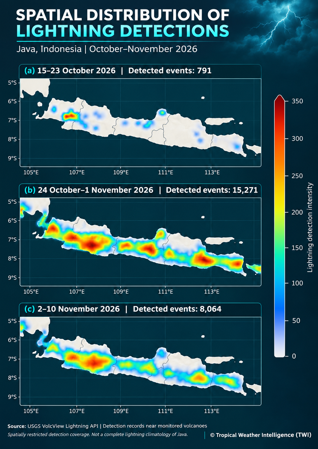
Interpretation and limitation. The detection counts fluctuate substantially across the three sampling windows, but the VolcView feed is oriented toward monitored volcanoes, not a uniform island-wide lightning network. The sample therefore cannot establish that total lightning activity across Java increased or decreased by these proportions; spatial coverage, retrieval conditions and detection characteristics need to be examined before making a seasonal or causal comparison. Nevertheless, the figure is useful for illustrating localized clusters of detected electrical activity during this transition period.
Practical precautions
When thunder is heard, seek shelter in a substantial building or a fully enclosed hard-topped vehicle. Avoid isolated trees, open fields, ridgelines, exposed water, and contact with electrical or plumbing installations during nearby storms. Wait at least 30 minutes after the last thunder before resuming exposed outdoor activity.
For broader hydrometeorological preparedness, review local drainage, monitor flood-prone routes, secure lightweight roofs and outdoor objects before storms approach, and follow official local warnings. TWI provides independent scientific interpretation, not an operational warning service.
References
- NOAA National Severe Storms Laboratory. Severe Weather 101 — Lightning Types.
- NOAA National Severe Storms Laboratory. Lightning FAQ — Cloud Electrification.
- NOAA National Weather Service. Understanding Lightning Science.
- USGS VolcView. Lightning API documentation — scope and retention limits.