
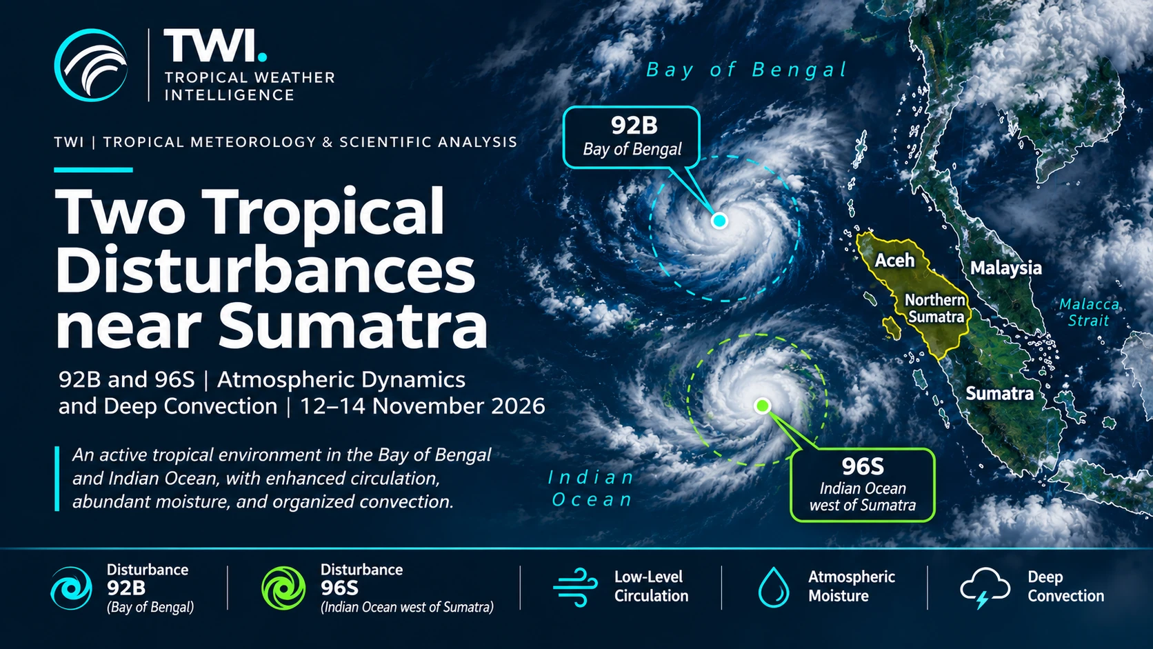
Two tropical disturbances emerged over neighbouring ocean basins during 12–14 November 2026: 92B in the Bay of Bengal and 96S over the Indian Ocean west of Sumatra. Their proximity to northern Sumatra highlights why monitoring tropical weather requires more than watching for named cyclones.
Tropical Weather Intelligence (TWI) independently examined NOAA/NCEP GFS atmospheric analyses and Himawari-9 infrared observations. The results reveal cyclonic vorticity in the lower troposphere, abundant atmospheric moisture, and a marked redistribution of cold convective cloud tops within 48 hours.
Two disturbances, two ocean sectors
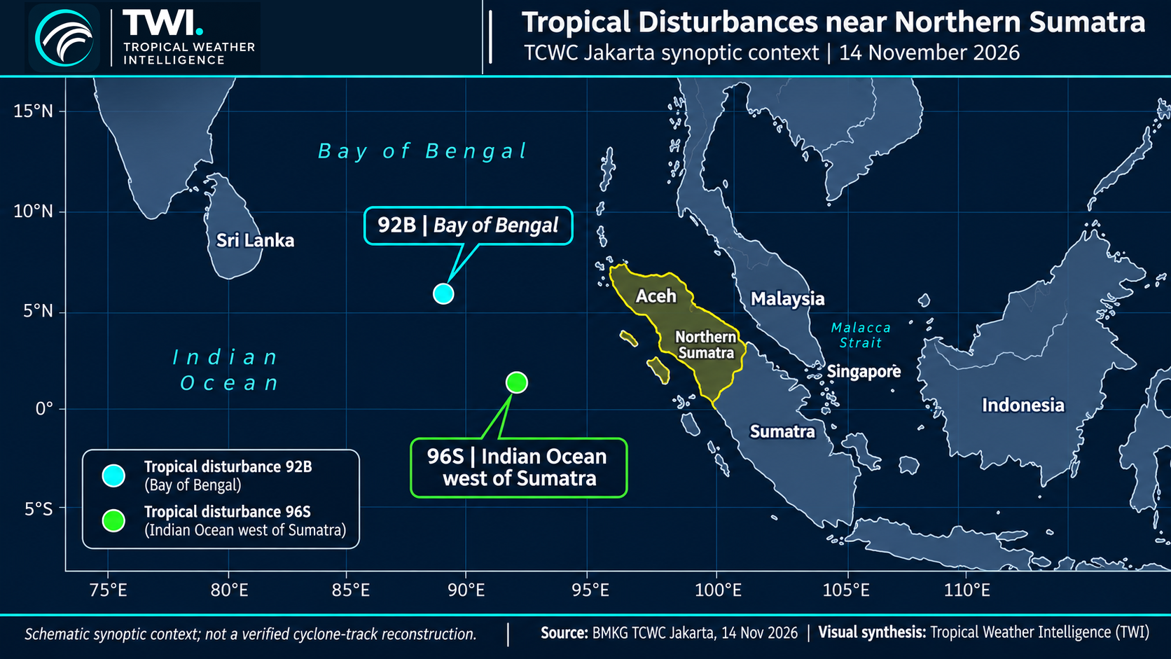
Disturbance 92B was identified in the Bay of Bengal on 12 November, followed by 96S west of Sumatra on 13 November. Figure 1 places both systems in their broader regional setting. The infographic is a schematic aid to orientation; it does not imply two established, mature cyclones or direct interaction between the disturbances.
Northern Sumatra borders the eastern Indian Ocean and lies southeast of the Bay of Bengal. Changes in circulation across these ocean sectors may influence moisture pathways, convection and offshore weather. Their potential impact on land nevertheless depends on the evolving wind and rainfall patterns, not simply the presence of a tropical disturbance.
What the low-level circulation reveals
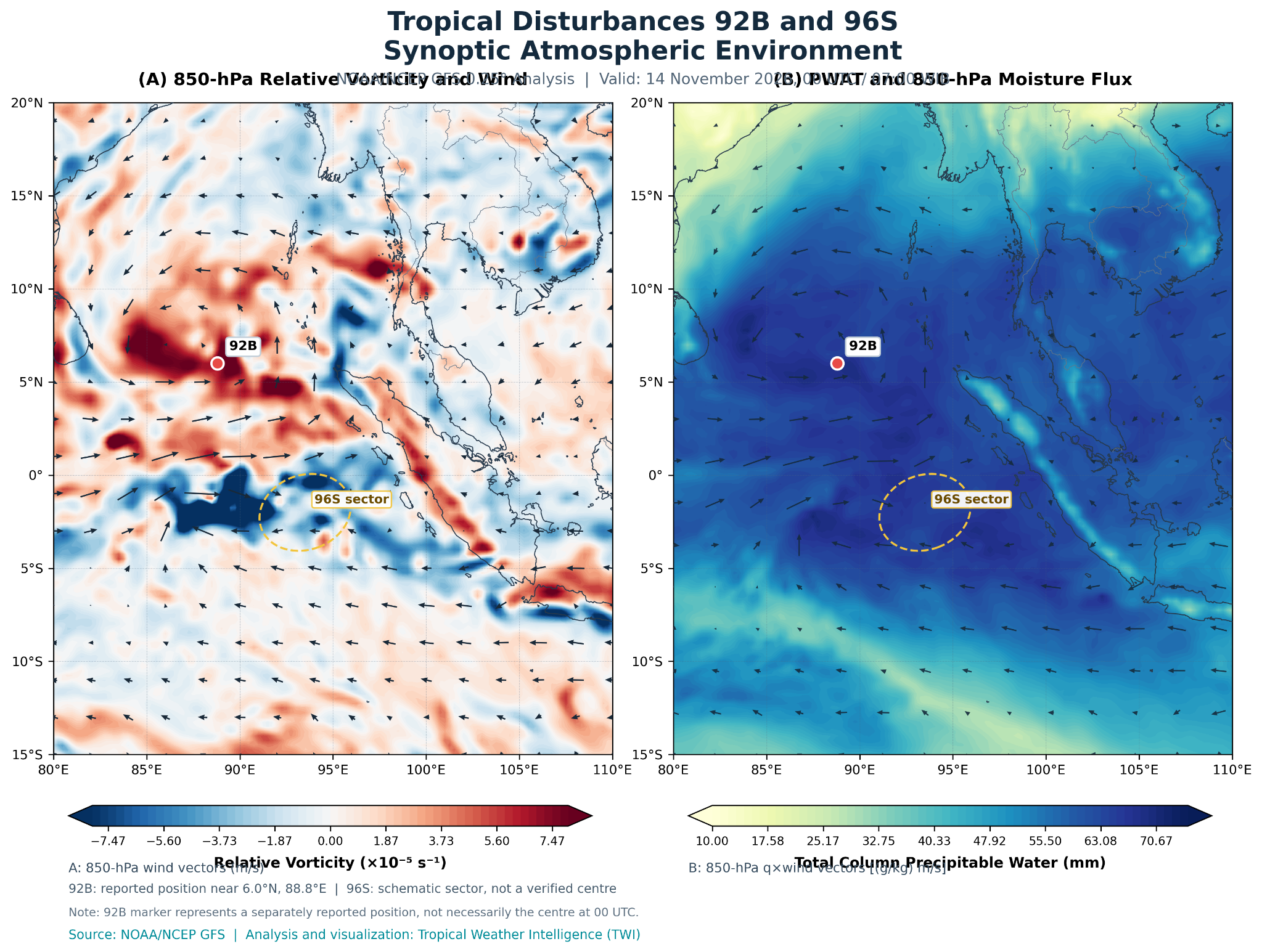
Figure 2A shows positive relative vorticity in parts of the Bay of Bengal near the reported regional position of 92B, indicating cyclonic rotational components in the 850-hPa wind field. Several local maxima are also distributed across the wider domain, including shear and convective-flow regions. A vorticity maximum is an important diagnostic, but on its own it does not establish a vertically coherent cyclone.
Figure 2B shows substantial precipitable water across tropical waters and the accompanying humidity-weighted 850-hPa winds. This combination illustrates both the availability of atmospheric moisture and its low-level horizontal transport. Deep convection can intensify where moisture availability coincides with instability and lifting, but this panel does not diagnose vertically integrated moisture transport or moisture-flux convergence.
What changed in the infrared satellite images?
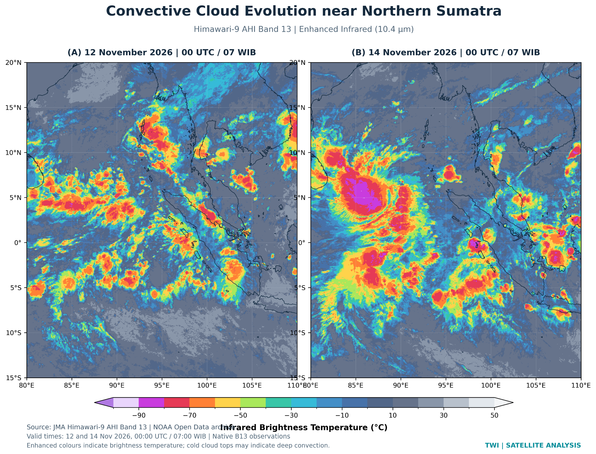
On 12 November, cold convective cloud tops were spread across numerous clusters over the Bay of Bengal and the eastern Indian Ocean. By 14 November, the imagery shows a broader, more concentrated region of very cold cloud tops in the southern Bay of Bengal, alongside extensive convection west of Sumatra. This is a visible change in convective organization across two observations 48 hours apart.
Enhanced infrared colours represent calibrated brightness temperatures, not rainfall intensity or surface wind speed. Very cold cloud tops can indicate deep convection, but two satellite snapshots alone cannot determine cyclone intensity, the precise centre of circulation or its full evolution.
Why the development matters for Aceh and northern Sumatra
Tropical disturbances offshore can modify lower-level winds and pathways of water-vapour transport. When these changes coincide with instability, convergent flow and the complex terrain of northern Sumatra, rainfall may become locally stronger or more persistent. The specific outcome requires monitoring of the circulation and convective systems as they evolve.
A tropical disturbance does not need to become a named cyclone to deserve attention. For communities in Aceh and northern Sumatra, persistent rainfall, upstream catchment conditions and changes in coastal weather may be more relevant to immediate risk than the naming status of a distant system.
These observations also should not be used to attribute all flooding reported earlier in November to 92B or 96S. Their formation dates overlap only the later part of the flood-event period; event-by-event attribution would require time-resolved rainfall, circulation, hydrological and ground observations.
Scientific interpretation and outlook
The combined evidence points to an active regional tropical environment during 12–14 November 2026: enhanced cyclonic vorticity in the Bay of Bengal, substantial tropical moisture and changing deep-convective cloud organization. A useful next diagnostic would combine sequential 850-hPa circulation analyses with moisture-flux convergence, vertical wind shear and high-frequency rainfall observations.
Continued monitoring of 92B and 96S should focus on changes in low-level circulation, convective persistence and rainfall-producing cloud systems rather than on cyclone classification alone. This is a meteorological context analysis, not an operational forecast or a substitute for official warnings.
Scientific data and sources
- NOAA/NCEP Global Forecast System — 0.25° analysis, 14 November 2026, 00:00 UTC.
- JMA Himawari-9 AHI via NOAA Open Data — Band 13, 12 and 14 November 2026, 00:00 UTC.
- TCWC Jakarta tropical-disturbance monitoring — regional identification of 92B and 96S, 12–14 November 2026.
Data note. Figure 1 is a geographic schematic. Figures 2 and 3 derive from GFS analysis and calibrated Himawari-9 observations respectively. The 92B context marker was reported separately from the GFS valid time; 96S has no independently verified precise centre in the plotted analysis. The satellite cover is an editorial illustration, not an observed cyclone structure or track. All scientific plots retain their original datasets and timestamps.